Thursday, July 18, 2013

Day 62, Missoula and then pretty Idaho

Day 62 Darby to Missoula. I was keen to get the 60 miles to town early so was on the road by 7 and only stopped quickly for a coffee outside Hamilton before stopping again for another at Lolo. It was mostly bike lane but I felt it was more effort than riding on the road. After chatting to interesting characters at the gas station and also to a Kiwi cyclist I pushed onto Missoula on the shoulder of the busy highway. A marathon had just finished so it was easy enough for me to get a room at the Days Inn (free upgrade to king size bed) around 1pm which left me time to meet Norah and go for a few beers at the Tamarack Brew Pub and for food at the Old Post. Both were excellent and set me up nicely for a relaxed evening of laundry, grocery shopping and Netflix. Missoula really does have a nice atmosphere, lots of good coffee shops and bars. I wish I'd had more time to visit the Big Sky Brewery outside town - next time!

Day 63 Missoula to Idaho (Powells campground). Nights sleep was interrupted by drunk middle aged bikers. Otherwise not too bad :) First stop today was the Adventure Cycling Headquarters where Julie gave me and Tim a full tour of the building and then Beth weighed my bike (90lbs!!). A really great place with some cool memorabilia adorning the walls including bicycles used on the first Trans Am in '76. After spending a couple of hours hanging about it was time to head out and over the state line. Back along the highway to Lolo and then along highway 12. Narrow shoulders but relatively light traffic. Unfortunately the surface was quite bumpy and there were headwinds so it was tough getting to Lolo Hot Springs. Even so, I was determined to get up and over the pass. A long, sweaty and exhausting job! The descent into Idaho though was worth the effort - a deep valley with enormous pine trees was on the other side of the mountain. The soft evening sunlight really made the last few miles memorable. I stopped with Time at Powell's campground where we camped behind the store for free ($5 for showers).  

Day 64 Powell to Harpster. This included a 66 mile section through the Clearwater national forest without services so I started at 6.40 and carrying extra food and water. Tim had started earlier so i could take my time today. The road follows the Lochsa river along the valley so it was a spectacular ride. I stopped to make sandwiches on a bridge at Eagle mountain pass as well as stopping at an old historical ranger station on the route. I eventually hit Lowell around midday and could order some cooked food from the cafe there. I pushed on to Kooskia and then to Harpster where I stayed at the RV park ($6). A total of 102.5 miles (mostly downhill) so I was pooped. I accidentally left my credit card in the shop so have to wait for it to reopen tomorrow to get it back. 

Day 65 Harpster to Riggins
I also temporarily mislaid the toilet key this morning so it was touch and go till the shop reopened. I also got my card back so both morning crises averted. On the road at 7.30 and riding solo again today. First 11 miles were on a steep grade with heavy truck traffic. It took me 2 hours to reach Grangeville where I promptly sat down for a big (omelette) breakfast at Oscars (were a big dead stuffed bear is posed on the wall). Another big climb on the way to White Bird but the summit has fantastic views of the valley. The downhill is on old highway 95 and had no traffic. The downhill was very twisty, fast and a lot of fun (10 miles long). Soup and a brownie at the bottom and then onto Riggins through the arid looking Salmon river canyon. Back on Highway 95 proper but there were some shoulders and traffic was moderate. Another RV park ($15) and a swim in the river (very refreshing!) and then to sleep. Riggins looks to be a good place to go white water rafting/canoeing - another place I'd like to come back to if I get the chance. 61.5 miles today. 

Day 66 Riggins to Council. On the road at 8.20 but felt slow getting to Pollock. A coffee and a snickers bar seemed to get me going up the uphill grades. Lots of logging trucks and also trucks carrying other trucks (?!) so the road wasn't that pleasant. More relatively easy climbing into the town of New Meadow where a couple of east bounders, Shawn and Paul, stopped to chat at the coffee shop. They warned me about some upcoming roadworks between Council and Cambridge and that the Weiss river trail is tough going on road bikes. I said goodbye and then I was on my way. Also just near the town I passed a sign stating that i was half way between the equator and the North Pole - strange place to have it! Anyway, I only got a couple of miles out then had to return because I'd left my water bottles behind! Not a bad detour but a little annoying. I needed those bottles though as the temperatures were close to 100F on the last 26 miles to Council. I got in around 3pm but it was so hot I decided to stay. The free camping in the city park is a good option and is close to shops and the library (where I filled out my upcoming Australian holiday visa app). Also had an interesting chat with Misty the local yoga teacher about indigenous people in South Africa. Interesting place Idaho!


Wednesday, July 10, 2013

Day 57 to 61, last day in Yellowstone and into Montana

Day 57 Grant Village to Madison started great. I felt super relaxed as I woke at 7.30. Both Mel and Norah left for coffee so I got straight on the road, I wanted to see the famous Old Faithful geyser. First there were two big climbs to cross the divide twice before that point. As I was out early traffic was light and the park was stunning in the early morning. Both climbs were steady with a great downhill spin between them descending to the pine forest valley.

I stopped at a picnic site for a break and had it to myself before pushing towards the geysers. I got there just in time to see Old Faithful erupt which was pretty cool. In the visitor center I spent some time learning about the volcanic activity beneath the park that creates the huge number of geysers and hot springs in this area. I walked around looking at the other geysers and lakes nearby - the micro bacteria that fed off the heated water create vivid colors - the most spectacular being the Grand Prismatic Spring, the largest heated pool in the park.

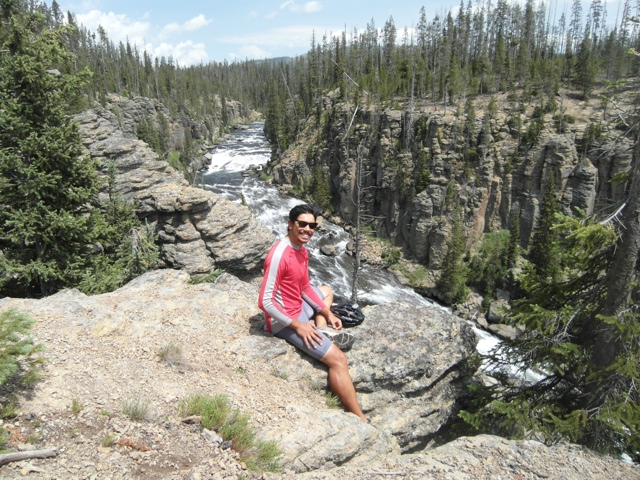
I kept cycling alongside the Firehole river, spotting wild deer, then going for a swim in the 'cascades of the Firehole', a swimming hole at a relatively calm section of the river. After all of this I was totally beat and not quite ready to leave this amazing park so I went to the nearby camp at Madison and got a pitch for the hiker/biker price ($6.80) and had an early night.

Day 58 Madison to Ennis. So it was time to keep pushing into Montana. I left camp at 6.45 to get ahead of traffic and any bad weather. 14 miles to get out of the park to the tourist town of West Yellowstone. Met a Scot and an English lad on the way out and was good to trade stories. Also saw another large group of either deer or antelope grazing by the steaming river. Quick picture opportunities at the state sign posts and then breakfast at Buffalo Bills where I asked a French family to get a pic with me wearing a cowboy hat (we are in the Wild West!).

Montana looks similar to Yellowstone at first with pines. Rounded a huge lake nestled in a valley surrounded by tall hills. Then through an interesting area that experienced a large earthquake in 1959. Really flat or slightly downhill with a good tailwind all day meant that I could blitz along the straight roads all the way to Ennis by 2pm (86 miles). It's a cool town, mostly restored from how it looked back in the gold rush days. Now people flock here for fishing in the Madisson river. I checked into the RV park with two other cyclists (kiwi David and Michigan Ed)pitched my tent, did laundry and then went to the local saloon to try some local beers (Moose Drool and Pigs Ass) before heading back to camp for bed time.

Day 59 Ennis to Dillon. Just past Ennis is a long steep climb before the old gold rush towns of Virginia city and Nevada city. I started early but it still took over 2 hours to travel the 12 miles or so to the crest of the pass. Great views behind me of the lush grass pastureland valley. A fun and rapid descent to the towns on the other side was my reward for climbing. I took some pics of the old Western buildings and gold mining equipment but nearly everywhere was closed at the time. I did get breakfast at the star bakery in Nevada city which was excellent (sundries tomato and spinach omelette!).

The wind started to pick up but luckily for me it was downhill to the Town of Twin Bridges. By then the headwinds were gusting heavily so I took shelter in the overnight bike facility there and bumped into Tim from NJ. Chatted with him a while then decided to push the last 24 miles to Dillon. This was extremely tough with heavy headwind, no shoulder, heavy truck traffic and some hills. 3 and a half hours later I rolled into Dillon exhausted. I saw Norah who was camping behind a church in town so I pitched up there. Felling a bit better after a rest we went to see superman at the cinema and I had an expensive shower at the Exxon gas station ($10). Time to sleep - today's 70 miles were tough.

Day 60 Dillon to Wisdom. Norah had left early so I took my time to pack up. The nights sleep had been pretty poor. The church bell rang on the hour and also at half past the hour throughout the night! It was free though so you certainly get what you pay for. The elevation profile showed two large passes to climb today with an overall steady elevation gain. Badger pass was first, rising over 1500 ft from Dillon, taking a couple of hours but was not overly difficult. It opened up into a pretty dry looking valley with some ranches where I took a snack and water break. Then the second climb started alongside a gusting headwind which made me stop more than once to catch my breath. Finally over Big Hole Pass (elevation 7360ft), I stopped at a Lewis and Clark historical info point (there are lots of these throughout the state) for another rest and chatted to a nice couple of tourists (kiwi and scot). Then I battled the headwind downhill to Jackson where I stopped for a burger and watched a Dudley Moore film on TV ('Arthur' - it was awful).

Miraculously the winds had shifted to a tailwind and it only took just over an hour to travel the final 18 miles to Wisdom where cyclists can camp in the (mosquito infested, cow surrounded) town park. Pitched my tent inside a hut to keep away from the insects. NJ Tim arrived later on so we chatted a while before heading to sleep.

Day 61 Wisdom to Darby. Today has the final climb on this section of the map over Chief Joseph Pass (7241ft). I got on the road just after 9 (it was a pretty cold morning) and stopped after an hour at the Big Hole Historical Battlefield. Here I learnt how the American army attacked an Indian village unawares in the early morning back in the late 1800's. I met a couple of German lads cycling and we climbed the pass together. The valley was another pretty pine forest with creeks with clear water. The downhill was great fun. It was fast and winding on a good road and lasted about 7 miles before flattening out towards the town of Sula. I stopped here for lunch, then bumped into Tim again. He had taken the alternative gravel road route around the pass and had a blow out. We rode on to Darby where I checked into the Bitterroot Hide-A-Way RV park. I'm the only camper so pitched my tent near the showers. There wasn't one in Wisdom so taking one here was heavenly!


Friday, July 5, 2013

Day 50 to 56, into Wild West Wyoming

Day 50 Walden, over state line to Rawlins
Early in the morning I went back to the Moose Creek cafe for oatmeal and scrambled eggs and headed the 28 miles to the state line. Huge expanse of open sage bush and little traffic on the roads. Quick picture taking at the sign after climbing a long hill to get there. Through to the little town of Riverside where I ate a massive burger for lunch before continuing to Saratoga where hunters come all year because the hot springs keep the river from freezing in the harsh winters. I picked up some grocers in the supermarket where there were lots of animal hides and mounted heads in every aisle. Very rugged landscape (and rugged headwind) for barren 20 mile stretch before getting onto the shoulder of the highway. Eventually checking into a motel at 8pm after 109 miles for the day. A good blast to Rawlins and interesting introduction to Wyoming.

Day 51 Rawlins to Jeffrey City
This morning was relaxed and included skyping with Sonia, taking a shower, watching TV and two trips to the breakfast area. I met Dave and Sam at 10 and we got on the road. I didn't get to see Rawlins but I talked to a number of guys who were refitting the local refinery (and thus push up the prices of the motels in town). We climbed out of town to cross the continental divide and then hit a section at least 10 miles long of roadworks with no shoulder. With July 4th traffic this was a nightmare. When we did get the shoulder back before Lamont, the surface was so bad that we had to bump along slowly. Added to this was a gusting headwind! It took almost 2 hours to cover 15 miles. Extremely frustrating but hot lunch and brownies at the cafe in Lamont brought me back from a total meltdown. Wind died down on the way to Muddy Gap but torrential downpour stopped us in our tracks - I had to get the tent fly sheet out for emergency cover from rain and hail. The mountain storm passed and we finished in Jeffrey City for dinner and I pitched the tent on the grass behind the bar.

Day 52 Jeffrey City to Lander for July 4th
We rode with Tom who had come off the Great Divide trail and wanted to get to Lander by early afternoon to enjoy the days festivities. Good conditions so we made great time. There was a long 5 mile decent (6% grade) that was glorious, passing red sandstone cliffs with the Rockies in the distance. A couple of sections of roadworks but barely any traffic. Today's riding was much easier than yesterday's. We got to the city park in time for their annual Buffalo BBQ where we ate a lot (they were giving extras away from 2pm) and then we pitched our tents next to other riders and locals who wanted to camp in the park for the day. I showered in the hotel room of a guy called Ben who was following the Pony Express route, and then got talking to some locals camping nearby. Los, Dino and Daryl were Arapaho and Shoshoni Indians who took us to see a small bull ride out of town, then back to the main rodeo and fireworks near the city park. Great people and it was interesting to learn about their history and culture. They explained some of the Indian dances that I saw and what the meanings were as well as an insight into their spirituality. Mixed with the wild western bull riding this was a unique 4th of July!

Day 53 Lander to Dubois
Slept really well (despite fireworks going off through the night) and went to the local coffee shop till midday. Lander if definitely a cool town with its own set of hipsters and out door types. Was great to relax in a good coffee shop with wifi. Had to get on the road though and pushed on through the Windy River Reservation stopping every so often for food and water. More sage bush scrub land but also some very cool mountain formations. A great and imposing Crowheart Butte mountain, 'Split mountain' and another red sandstone valley provided awesome scenery through the day. Unfortunately a strong headwind for a third of it made it also tiring and really long. At 8pm I pitched my tent against the walls of the Lutheran Church in Dubois. It was too late for me to explore the town although it looked to have some cool old style Wild West shop facades in the town centre.

Day 54 Dubois to Grand Teton National Park
Just where I camped there was a laundromat that also had showers (50cents a minute) so a group of us spent a couple of hours there before heading out to tackle Togwotee pass at 9658 feet. More headwind in windy Wyoming so this slowed me down. Then about three quarters of the way up another heavy mountain rain and hail storm hit. The terrain has changed from scrubland to pine forest so we took shelter waiting for the rain to ease off. When it did we summited and headed down the other side around 2pm. Long cold down hill in light rain and freezing wind. Good thing I had all my wet weather gear on. The others didn't and decided to stay in a lodge to warm up. I continued on my own and my gamble paid off, the rain stopped and two really cool things happened. First I saw three bears close to the road mating (or fighting) and second I got my first view of the Teton mountain range through the mists on the horizon. These are amazing mountains and as I got closer I kept could not stop taking pictures. I paid for a pitch at the Signal Mountain campsite on the edge of lake Jackson. It had views of the mountains as the sun went down. A quick swim in the lake and some time taking in the wonderful landscape before heading to bed. In bear country now so almost everything goes into the bear boxes!

Day 55 Teton Spur to Jackson and back to Coulter Bay
The Teton spur is roughly a 50 mile round trip off route to Jackson and back. I had seen the day before that my rear tyre looked worn out. Checking it today revealed that it had no tread in a number of places. I had to get replacements in Jackson. I wanted to do it anyway as the majority of the route takes you on a bike path close to the base of the mountains. This morning had a cloudless sky and no wind. An amazing two hours riding whilst gawping at the mountains above. The bike path winds around scenic Jenny Lake and then blasts to Jackson. A very cool town and got to Hobacks bike shop at 11. Brian and Jacques who worked at the shop and had completed the Trans am a couple of years ago provided company whilst I switched out my tires and cleaned the drive train outside the shop. Also thanks to Terry and his wife who offered brunch but I was knee deep in chain grease and WD40 at the time. I did end up going to a cool cafe (St Genevieve) for brunch and meeting back up with Norah and Georgian Dave. After relaxing in the city park we headed back to the route. We narrowly missed another mid afternoon rainstorm by going to the shops in Moose, then pushed onto Coulter Bay - another campsite on the lake. At dusk the mosquitoes were vicious so I hid in my tent as soon as it was set up.

Day 56 Coulter Bay, into Yellowstone Park, camping at Grant Village.
I felt relaxed this morning. I think it's because of how beautiful the environment is. I stayed in my sleeping bag till 7.30 and then took two hours to pack and get showered. The ride out of the Tetons was lined with more pine trees, with the lake on our left. Traffic was not too heavy but we were forced to get in the back of a rangers pick up truck to bypass a section of road works. I was getting excited to enter Yellowstone and as we rode through I stopped often to take pictures of the rivers, valleys and lakes. A lot of the road was uphill so some steady climbing to get a sweat up. I had heard that traffic is very bad and dangerous - today seemed no worse than that in Missouri. Hopefully it will remain light. Around 4pm I decided to stop in the Giants Village campsite where bikers can pitch for $6.80 a night. A short day of just under 40 miles. I don't want to rush through Yellowstone though! The afternoon was spent relaxing, quickly seeing high altitude Yellowstone lake (which looked way too cold to dip in) and writing this post.